What is cartography?
Modern cartography is a design process which combines artistic and scientific elements with colour theory, graphic perception, and unique design elements. Altogether these create an aesthetically pleasing whole, which imparts knowledge to the percipient.
Rapid changes in the field, both in analytical methods and visualization techniques, have pushed cartography past ‘drawing a map’ and into an era where the perception of data can be manipulated to convey a very specific intent, sometimes irregardless of what the data may actually imply.
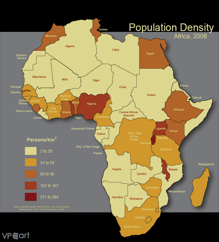
Population density maps are one of the most common types of choropleth maps.
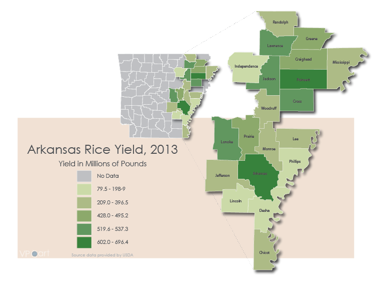
'Arkansas Rice Yield' demonstrates one of the best reasons to use an inset map----ensuring that your audience knows where you're mapping as well as what you're mapping.
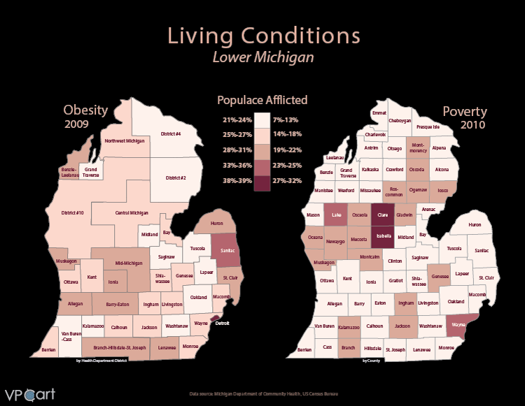
'Living Conditions' demonstrates how a common color palette can be used to compare two different variables using choroplethy.
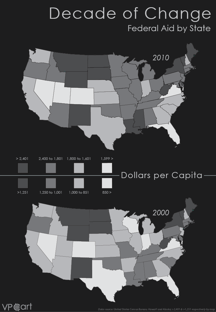
This version of 'Decade of Change' made for black and white print shows the amount of federal aid per person by state.
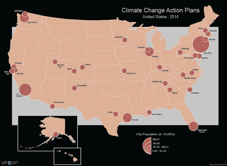
Proportional symbols uses different sized symbols to emphasize data classifications. 'Climate Change Actions Plans' shows cities and counties in the United States that have climate change plans in place and, the symbols are proportional to the population of each area.
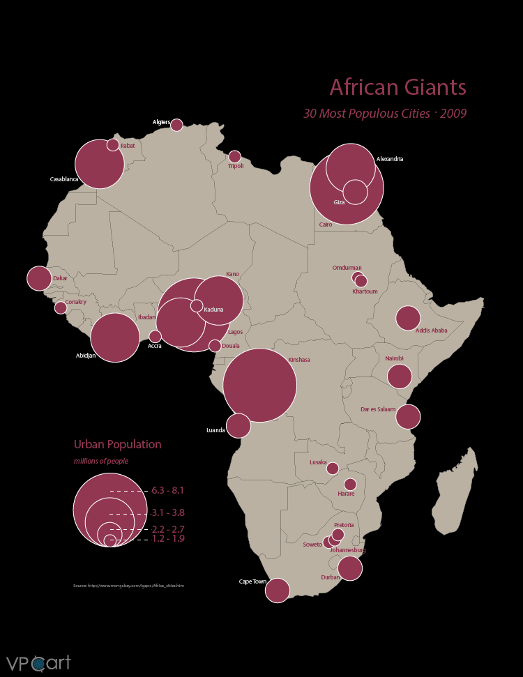
'African Giants' illustrates the 30 largest cities in Africa with symbols that are proportional to the population of each city.
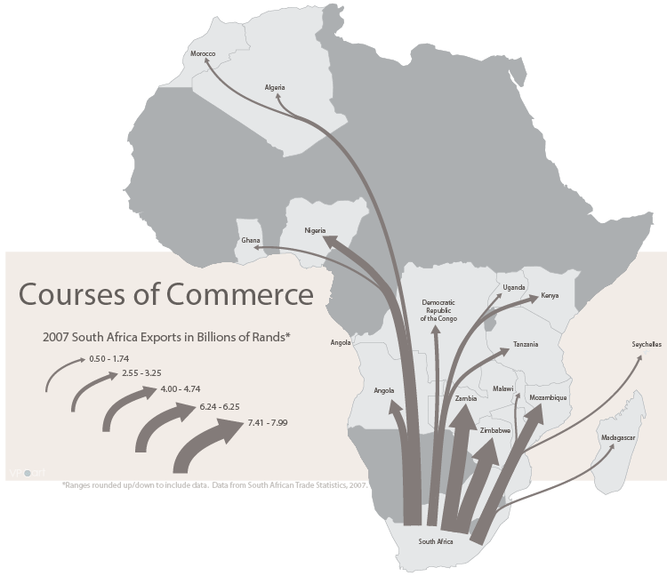
Flow maps are often used to represent directional data. 'Courses of Commerce' displays export data from South Africa.
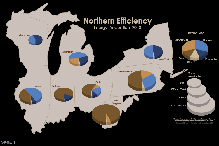
Sectored coins are used to represent data classifications within data. In 'Northern Efficiency', each coin is proportional in size to the total amount of energy produced in the American "Rust Belt."
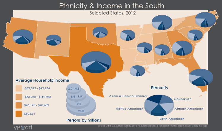
'Ethnicity & Income in the South' features is a combination of choropleth and sectored coin maps for selected states.
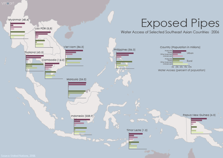
Horizontal bar maps are used to represent multivariate data similar to sectored coins. In 'Exposed Pipes', 2006 water access data from the United Nations is shown for some of the southeast Asian countries for urban and rural populations.


